headerdesktop corintwktrgr26apr24

MAI SUNT 00:00:00:00

MAI SUNT

X

headermobile corintwktrgr26apr24

MAI SUNT 00:00:00:00

MAI SUNT

X

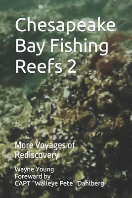
Chesapeake Bay Fishing Reefs 2: More Voyages of Rediscovery

Chesapeake Bay Fishing Reefs 2: More Voyages of Rediscovery - Walleye Pete Dahlberg

Chesapeake Bay Fishing Reefs 2: More Voyages of Rediscovery

Progressively building knowledge, skills, and abilities through hands-on experience under varying conditions is necessary to learn how, when, and where to fish Chesapeake Bay structure through the range of constantly changing conditions and seasonal patterns. Yet one could spend a lifetime fishing the Bay and its tributaries and uncover but a fraction of Neptune's secrets. Finding hotspots to prospect for fish remains challenging even with modern sonar technology, especially for those who don't know where to start looking.

The Author uses online armchair scouting resources to jumpstart acquiring local knowledge that would otherwise take years to develop. He presents not only where to find natural and artificial reefs, wrecks, rocks, ruins, and obstructions, but also details and illustrates what is actually there and provides coordinates. In this volume, with a foreword by professional guide Captain "Walleye Pete" Dahlberg, he picks up the storyline from Chesapeake Bay Fishing Reefs (2020) by expanding the presentation of structure that provides marine habitat and recreational fishing hotspots in areas that weren't well covered other than by sounding data. Content is designed for new recreational fishermen looking where to begin their acquisition of local knowledge about where to fish, occasional fishermen seeking to optimize available fishing time, and veteran fishers expanding to other fishing grounds.

Coverage starts with the tidal Susquehanna River and Flats, down the Upper Bay and outer Patapsco River to and including the Bay Bridge, then south to Cove Point on the West side and Pocomoke Sound on the east side, and around Cape Charles covering the north side of the Chesapeake Bay Entrance. Updated illustrated reef layouts are included for Plum Point, Dominion Reef at the Gooses, Mobjack Bay, Poquoson, York Spit, Bluefish Rock, The Cell, and Cabbage Patch Reefs. Also included are new data for Stone Rock, dozens of lighthouse ruins and icebreaker rocks Bay-wide and in the Potomac and Rappahannock Rivers, and yet another undocumented artificial reef in the Lower Bay. Boating and fishing safety practices are also featured. Whether new to fishing or a veteran, fishers will find clusters of hotspots to plan fishing trips around.
Citeste mai mult

-10%

transport gratuit

PRP: 246.22 Lei

!

Acesta este Pretul Recomandat de Producator. Pretul de vanzare al produsului este afisat mai jos.

221.60Lei

221.60Lei

246.22 Lei

Primesti 221 puncte

Important icon msg

Primesti puncte de fidelitate dupa fiecare comanda! 100 puncte de fidelitate reprezinta 1 leu. Foloseste-le la viitoarele achizitii!

Livrare in 2-4 saptamani

Descrierea produsului

Progressively building knowledge, skills, and abilities through hands-on experience under varying conditions is necessary to learn how, when, and where to fish Chesapeake Bay structure through the range of constantly changing conditions and seasonal patterns. Yet one could spend a lifetime fishing the Bay and its tributaries and uncover but a fraction of Neptune's secrets. Finding hotspots to prospect for fish remains challenging even with modern sonar technology, especially for those who don't know where to start looking.

The Author uses online armchair scouting resources to jumpstart acquiring local knowledge that would otherwise take years to develop. He presents not only where to find natural and artificial reefs, wrecks, rocks, ruins, and obstructions, but also details and illustrates what is actually there and provides coordinates. In this volume, with a foreword by professional guide Captain "Walleye Pete" Dahlberg, he picks up the storyline from Chesapeake Bay Fishing Reefs (2020) by expanding the presentation of structure that provides marine habitat and recreational fishing hotspots in areas that weren't well covered other than by sounding data. Content is designed for new recreational fishermen looking where to begin their acquisition of local knowledge about where to fish, occasional fishermen seeking to optimize available fishing time, and veteran fishers expanding to other fishing grounds.

Coverage starts with the tidal Susquehanna River and Flats, down the Upper Bay and outer Patapsco River to and including the Bay Bridge, then south to Cove Point on the West side and Pocomoke Sound on the east side, and around Cape Charles covering the north side of the Chesapeake Bay Entrance. Updated illustrated reef layouts are included for Plum Point, Dominion Reef at the Gooses, Mobjack Bay, Poquoson, York Spit, Bluefish Rock, The Cell, and Cabbage Patch Reefs. Also included are new data for Stone Rock, dozens of lighthouse ruins and icebreaker rocks Bay-wide and in the Potomac and Rappahannock Rivers, and yet another undocumented artificial reef in the Lower Bay. Boating and fishing safety practices are also featured. Whether new to fishing or a veteran, fishers will find clusters of hotspots to plan fishing trips around.

Citeste mai mult

De pe acelasi raft

Parerea ta e inspiratie pentru comunitatea Libris!

Acum se comanda

Noi suntem despre carti, si la fel este si

Newsletter-ul nostru.

Aboneaza-te la vestile literare si primesti un cupon de -10% pentru viitoarea ta comanda!

*Reducerea aplicata prin cupon nu se cumuleaza, ci se aplica reducerea cea mai mare.

Ma abonez image one
Ma abonez image one